
Josephine County trails
Click on a trail to view its statistics, map and profile.
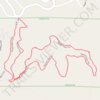
GoMap__2026_10_24__15_04_29
United States > Oregon > Josephine County
Distance: 2.7 Km • Elevation gain: 74 m • Maximum elevation: 434 m

Cathedral Hills
United States > Oregon > Josephine County
Distance: 6.4 Km • Elevation gain: 227 m • Maximum elevation: 455 m

Dollar Mountain Loop Trail
United States > Oregon > Josephine County > Grants Pass
Distance: 7.1 Km • Elevation gain: 423 m • Maximum elevation: 553 m

Stringer Gap Loop Trail
United States > Oregon > Josephine County
Distance: 3.3 Km • Elevation gain: 81 m • Maximum elevation: 445 m