
מסלול לסיור עששיות בין שדות כפר מע"ש
- Distance: 1.7 Km
- Elevation gain: 15 m
- Maximum elevation: 53 m
- Elevation loss: 15 m
- Minimum elevation: 40 m
- Moving time: 22 m 25 s
- Moving speed: 4.5 Km/h
- Maximum speed: 5.8 Km/h
- Total time: 22 m 25 s
- Global speed: 4.5 Km/h
Interactive trail map
Trail profile
- Distance: 1.7 Km
- Elevation gain: 15 m
- Maximum elevation: 53 m
- Elevation loss: 15 m
- Minimum elevation: 40 m
- Moving time: 22 m 25 s
- Moving speed: 4.5 Km/h
- Maximum speed: 5.8 Km/h
- Total time: 22 m 25 s
- Global speed: 4.5 Km/h
About this trail
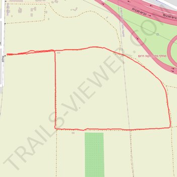
Name: מסלול לסיור עששיות בין שדות כפר מע"ש trail, distance, elevation, map, profile, GPS track
Coordinates: 32.06317 34.89501 32.06595 34.90145
Topography: Drom HaSharon Regional Council topographic map, elevation, terrain